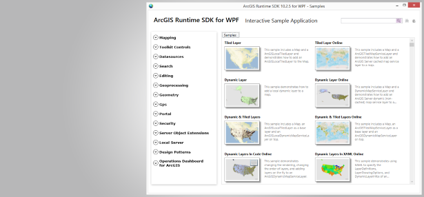
Create focused, light-weight mapping and analytical applications with Microsoft's WPF technology. The 10.2.5 release follows the 10.2.3 release and includes functionality enhancements as well as improvements in quality and performance.
Read more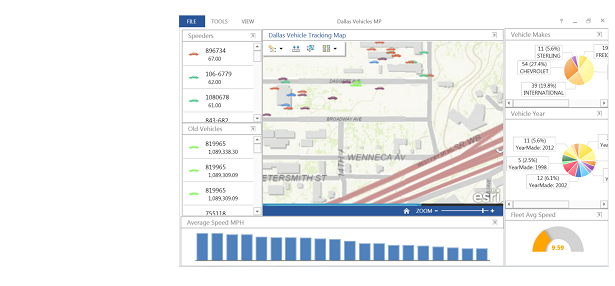
The ArcGIS Runtime SDK for WPF brings the extensibility you need to add widgets and other customizations to your Operations Dashboard.
Read more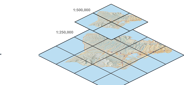
Using tile packages can make your maps run faster. Learn how to easily create tile packages for your offline applications.
Read moreArcGIS Earth 1.7 Beta is now available. ArcGIS Earth is an experience for browsing a variety of spatial data for non-GIS specialists. While online, ArcGIS Earth connects directly to the ArcGIS platform allowing users to leverage the Web GIS pattern, … Continue reading
At the 2018 Dev Summit in Palm Springs, I introduced the Esri arcade-expressions GitHub repository, which can be used for creating Arcade expression templates to share with others for reuse. Providing a mechanism for sharing Arcade expressions has been a … Continue reading
On March 20th over 4,500 professionals will gather for the 2018 Esri Federal GIS Conference (#FedGIS). The two-day conference allows attendees to explore ground-breaking ways government use geospatial technologies to solve the world’s greatest challenges. Join our community and Esri … Continue reading
Elevation surface provides foundational layer for your work in 3D. ArcGIS 3D clients such as ArcGIS Pro, ArcGIS Online Web Scene Viewer, and ArcGIS Earth comes with a default elevation layer – Terrain 3D. Along with this default elevation layer, ArcGIS Living Atlas … Continue reading
A brief summary of additions to the ArcGIS API for Python at version 1.4 released in March of 2018. Continue reading


