Description
Used to display features using one symbol.Used to display features using one symbol.
Diagram
Overview
 |
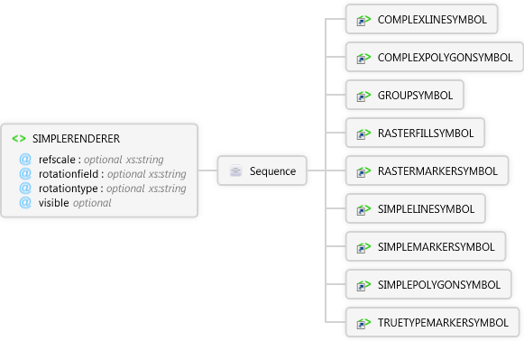
SIMPLERENDERER
Used to display features using one symbol.Used to display features using one symbol.
 |
refscale optional xs:string
Reference scale to display the TRUETYPEMARKERSYMBOL or SIMPLEMARKERSYMBOL at the specified fontsize using a relative scale such as 1:24000. TRUETYPEMARKERSYMBOLs and SIMPLEMARKERSYMBOLs are scaled relative to the refscale as the map is zoomed in or out.
|
|
rotationfield optional xs:string
The field in the table that contains the angle of rotation for a TRUETYPEMARKERSYMBOL.
|
|
rotationtype optional xs:string
Three methods of calculating angles are available: 1)"arithmetic", An angle of 0 is east, and angles are calculated counterclockwise from east. 2)"counterclockwise", An angle of 0 is north, and angles are calculated counterclockwise from north. 3)"geographic", An angle of 0 is north, and angles are calculated clockwise from north.
|
|
visible optional Restriction of xs:string
In an ArcPad map file (.apm), specifies whether the SIMPLERENDERER element overrides the SIMPLERENDERER element in the layer's ArcPad layer file (.apl).
|
 |
Sequence
 |
COMPLEXLINESYMBOL
Used to symbolize line features. Provides additional symbology options beyond SIMPLELINESYMBOL.
|
|
COMPLEXPOLYGONSYMBOL
Used to symbolize polygon features. Provides additional symbology options beyond SIMPLEPOLYGONSYMBOL.
|
|
GROUPSYMBOL
Used to symbolize features with multiple symbols acting as a single symbol (e.g., a freeway line symbol consists of a group of 3 line symbols).
|
|
RASTERFILLSYMBOL
Symbolizes polygon features using the specified image as a fill symbol.
|
|
SIMPLEMARKERSYMBOL
Used to symbolize point features using one of the predefined symbol types: circle, square, cross, triangle, star, X, or diamond.
|
|
|
Attributes
| Name | Type | Use | Default | Fixed | Description |
|---|
| refscale | xs:string | optional | | | Reference scale to display the TRUETYPEMARKERSYMBOL or SIMPLEMARKERSYMBOL at the specified fontsize using a relative scale such as 1:24000. TRUETYPEMARKERSYMBOLs and SIMPLEMARKERSYMBOLs are scaled relative to the refscale as the map is zoomed in or out. |
| rotationfield | xs:string | optional | | | The field in the table that contains the angle of rotation for a TRUETYPEMARKERSYMBOL. |
| rotationtype | xs:string | optional | | | Three methods of calculating angles are available: 1)"arithmetic", An angle of 0 is east, and angles are calculated counterclockwise from east. 2)"counterclockwise", An angle of 0 is north, and angles are calculated counterclockwise from north. 3)"geographic", An angle of 0 is north, and angles are calculated clockwise from north. |
| visible | Restriction of xs:string | optional | false | | In an ArcPad map file (.apm), specifies whether the SIMPLERENDERER element overrides the SIMPLERENDERER element in the layer's ArcPad layer file (.apl). |
Remarks
Examples
Restrictions
One symbol must be specified. Only one is allowed.
Source
<xs:element name="SIMPLERENDERER" xmlns:xs="http://www.w3.org/2001/XMLSchema">
  <xs:annotation>
    <xs:documentation>Used to display features using one symbol.</xs:documentation>
  </xs:annotation>
  <xs:complexType>
    <xs:sequence>
      <xs:element ref="apm:COMPLEXLINESYMBOL" />
      <xs:element ref="apm:COMPLEXPOLYGONSYMBOL" />
      <xs:element ref="apm:GROUPSYMBOL" />
      <xs:element ref="apm:RASTERFILLSYMBOL" />
      <xs:element ref="apm:RASTERMARKERSYMBOL" />
      <xs:element ref="apm:SIMPLELINESYMBOL" />
      <xs:element ref="apm:SIMPLEMARKERSYMBOL" />
      <xs:element ref="apm:SIMPLEPOLYGONSYMBOL" />
      <xs:element ref="apm:TRUETYPEMARKERSYMBOL" />
    </xs:sequence>
    <xs:attribute name="refscale" type="xs:string">
      <xs:annotation>
        <xs:documentation>Reference scale to display the TRUETYPEMARKERSYMBOL or SIMPLEMARKERSYMBOL at the specified fontsize using a relative scale such as 1:24000. TRUETYPEMARKERSYMBOLs and SIMPLEMARKERSYMBOLs are scaled relative to the refscale as the map is zoomed in or out.</xs:documentation>
      </xs:annotation>
    </xs:attribute>
    <xs:attribute name="rotationfield" type="xs:string">
      <xs:annotation>
        <xs:documentation>The field in the table that contains the angle of rotation for a TRUETYPEMARKERSYMBOL.</xs:documentation>
      </xs:annotation>
    </xs:attribute>
    <xs:attribute name="rotationtype" type="xs:string">
      <xs:annotation>
        <xs:documentation>Three methods of calculating angles are available: 1)"arithmetic", An angle of 0 is east, and angles are calculated counterclockwise from east. 2)"counterclockwise", An angle of 0 is north, and angles are calculated counterclockwise from north. 3)"geographic", An angle of 0 is north, and angles are calculated clockwise from north.</xs:documentation>
      </xs:annotation>
    </xs:attribute>
    <xs:attribute default="false" name="visible">
      <xs:annotation>
        <xs:documentation>In an ArcPad map file (.apm), specifies whether the SIMPLERENDERER element overrides the SIMPLERENDERER element in the layer's ArcPad layer file (.apl).</xs:documentation>
      </xs:annotation>
      <xs:simpleType>
        <xs:restriction base="xs:string">
          <xs:enumeration value="true" />
          <xs:enumeration value="false" />
        </xs:restriction>
      </xs:simpleType>
    </xs:attribute>
  </xs:complexType>
</xs:element> |
See Also