ArcGIS for Ocean Use Planning is a community of GIS practitioners dedicated to enabling local, state, and federal government agencies to successfully apply GIS to a range of issues and activities.
ArcGIS for Ocean Use Planning is a community of GIS practitioners dedicated to enabling local, state, and federal government agencies to successfully apply GIS to a range of issues and activities related to ocean use throughout the nation's waters.
Read more...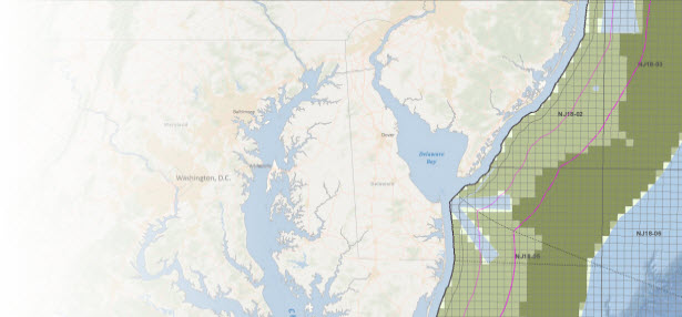
This map helps facilitate the siting of new wind energy projects in the Outer Continental Shelf by visualizing developable areas and reporting on their energy potential.
Read more...
Fisheries management involves regulating when, where, how, and how much fishermen are allowed to harvest to ensure sustainability.
Read more...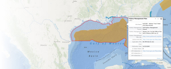
As our oceans are increasingly utilized for resource development for energy, ongoing fishing, and commercial shipping and trade, there is an increasing requirement to ensure that we conserve and protect sensitive marine habitats and historic sites.
Read more...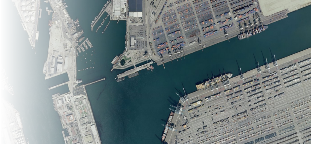
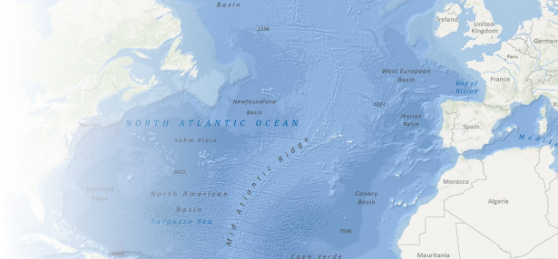
One of the key benefits of the Oceans community is the collection of rich, shared GIS content that many others can leverage in their own work. Critically important geographic information sets have been assembled and shared by the Oceans community.
Read more...For the first time ever, you can visualize NOAA’s stream-flow forecasts throughout the continental U.S. in ArcGIS Online, ArcGIS for Desktop or freely via the REST endpoint. By accessing the National Water Model map services, hosted on Esri’s livefeeds2.arcgis.com server, … Continue reading
Over the last ten years, the GIS community has seen an explosion of beautiful, high-resolution multi-spectral imagery, with very rich color fidelity, and very high pixel resolution. Lawrie Jordan, Esri’s Director of Imagery, has called this platinum age of imagery: … Continue reading
By Jim Herries and Tamara Yoder, ArcGIS Content Team Every item in ArcGIS Online has a thumbnail image to give a visual cue as to what the item is or contains. Have you noticed that items in the Living Atlas, … Continue reading
Visit the Living Atlas Content Area at the 2016 Esri User Conference! A modern GIS needs access to a wealth of foundational content. The Living Atlas is the foremost collection of authoritative, ready-to-use global geographic information ever assembled. The Living … Continue reading
A sample SOI (Server Object Interceptor) is made available that helps visualize on the fly aggregated results by overcoming challenges presented in an earlier blog post. A map service, powered by this SOI, can be used in the ArcGIS Online Map Viewer … Continue reading


